

You can find on this page the Sweden trains map to print and to download in PDF. The Sweden railways map presents the rail network and shows high speed rails routes of Sweden in Northern Europe.

The Sweden rail map shows all the railway stations and lines of Sweden trains. This train map of Sweden will allow you to easily travel by train in showing the major rail routes and high speed rail routes of Sweden in Northern Europe. The Sweden rail map is downloadable in PDF, printable and free.
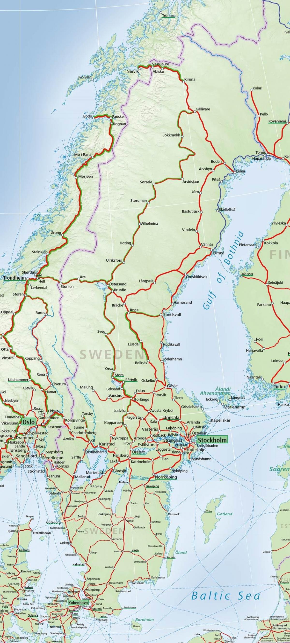
Rail transport in Sweden uses a network of 13,000 km of track, the 20th largest in the world. Construction of the first railway line in Sweden began in 1855 as its mentioned in Sweden rail map. The major operator is the state-owned SJ AB. Sweden is a member of the International Union of Railways (UIC). The UIC Country Code for Sweden is 74. The first Swedish railroad for public transport using horse-drawn carriages, the Frykstads railroad in Värmland was opened in 1849. In 1853 the Swedish Parliament decided that the state would build main line railways, but that other lines would be built by private enterprises (often with cities as main owners), and in 1856 the first stretch, between Örebro and Nora (a private railway), was opened for traffic. The main line railways were of major importance for the development of the Swedish industry. The first two main line railways were the Southern, stretching from Stockholm to Malmö in the south, and the Western, to Gothenburg in the west. These line railways were finished between 1860-1864.
There used to be six main rail lines (stambanor) in Sweden, all nationally owned as you can see in Sweden rail map: Västra stambanan (Western main line), 453 km, Stockholm-Gothenburg through Katrineholm-Hallsberg-Laxå-Falköping. Södra stambanan (Southern main line), 381 km, Malmö-Falköping through Nässjö-Jönköping. Östra stambanan (Eastern main line), 216 km, Nässjö-Katrineholm through Mjölby-Linköping-Norrköping). Norra stambanan (Northern main line), 484 km, Stockholm-Ånge through Uppsala-Avesta Krylbo. Stambanan genom övre Norrland (Main line through upper Norrland), 629 km, Bräcke-Boden through Långsele-Vännäs. Nordvästra stambanan (Northwestern main line), 209 km, Laxå-Norwegian border through Karlstad-Kil-Charlottenberg. Also these lines have for a period been called main lines: Mittbanan (Norrland cross line), about 500 km, Sundsvall-Norwegian border through Ånge-Östersund. Inlandsbanan, about 1300 km, Kristinehamn-Gällivare through Mora-Östersund.
Railway links with Sweden adjacent countries as its shown in Sweden rail map: Denmark - yes - Öresund bridge - same gauge - voltage change 15kVAC/25kVAC and train ferry Göteborg - Frederikshavn. Finland - yes, but break-of-gauge 1,435 mm (4 ft 8 1⁄2 in)/1,524 mm (5 ft) (short dual gauge track between the two stations closest to the border, without overhead lines. Train ferry Stockholm - Turku (Finland). Germany - yes - train ferry - same gauge - no electric propulsion onboard. Train ferry Malmö - Travemunde, Trelleborg - Sassnitz(Mukran) and Trelleborg - Rostock. Norway - yes - same gauge - same voltage (three electric lines and one non-electric). Poland - yes, train ferry Ystad - Swinoujscie - same gauge - no electric propulsion onboard. Some of the train ferries and routes.